April, 20th 2024

COVER PHOTO

Show results of 31 to 40 of total 91

_ANTERIOR - 1 - 2 - 3 - 4 - 5 - 6 - 7 - _SIGUIENTE

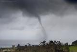
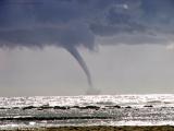
In the third week of March 2007, a series of northern cold-air masses came in over the north of the Spanish peninsula. They had a special effect on the Cantabrian coast: snow at low levels, strong winds, heavy rains, and hailstorms were common for a week. The picture shows a waterspout that took place in front of the coast of Comillas (Cantabria), on Wednesday 20th at 13,15. Jose A Gallego, member of SSW, took it from the small town of Canales. The phenomenon lasted about 10 minutes and due to the heavy rain at that moment it cannot be seen clearer.

Foto de la Semana 20-03-2007

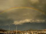
14th February, it happened something not very common of that time: a “galerna”. It took place in the Guipuzcoan coast. After a south-western wind, a cold and humid air mass took its place causing a sudden change in the wind direction, a rise in the ambient humidity, and a change in the cloud structure. It is also possible that it was simply a squall line in a winterly NW wind circulation, if we take into account the small distance covered by the “galerna”. The photograph of that precise moment was sent by Enrique Florit (Vortice), in which we can see a beautiful rainbow. It has in the background some threatening evolution clouds in the form of an arcus, where a few minutes before there were typical foehn clouds.

Foto de la Semana 14-02-2007

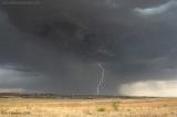
6th September 2006, a typical summer storm broke out in the central area of Spain, with relatively few and localized showers, and intense electric activity. In this picture, we can see a beautiful lightning in the middle of a plain in Madrid, a localized heavy shower, and maybe a small microburst (down right).

Foto de la Semana 06-09-2006
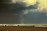
23rd January 2006, a cold air mass entered with north-western and northern winds causing heavy showers in the Cantabrian sea. Strong winds clashed with a sea that had not suffered the severity of the winter at the same level, and it was relatively warm. It caused storms and even some waterspouts in the coast. The waterspout shown in the photo, taken by Sebastián Vizoso, took place in the coast of San Sebastián, and it came together with a heavy storm.Foto de la Semana 23-01-2007
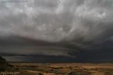
A wonderful supercell coming from SSW to NNE, covered the centre of Albacete. It came out not being very strong, rather ephemeral. However, the beauty of the image reminds us of the great American plains and the essence of severe weather: our reason to exist. The picture was taken in Chinchilla ( Albacete) in the evening of 17th June 2006 by Jose A Gallego, one of the main chasers in www.tiemposevero.com, whose works have been awarded with several prizes and published in some magazines.   Foto de la Semana 17-06-2006

On November 26th 2005, in the windy coast of Trafalgar, at the south of the Iberian Peninsula, and specifically from the area of the lighthouse, it could be observed a fantastic waterspout. The temperature was around 20ºC at 2:38 pm, and it was ground swell from the SW. Some disturbed areas came close to the coast, and from a cumulus congestus got down this waterspout, around one or two kilometres from the coast. We thank Gustavo Cuesta for sending us this and other pictures.

Foto de la Semana 26-11-2006

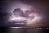
On September 12th and 13th of 2006, many stormy phenomena developed at the Mediterranean coast. It is the beginning of the storm season in that area, with a very warm sea, that is a perfect environment for great convection, if it is enough cold air at upper levels. This wonderful photo, one of the most beautiful of this year, was taken by Mariano Monell at the bay of La Palma, in the early morning of the September 13th. We clearly see the structure of the storm, although we are not sure about the existence of some rotation in it.

Foto de la Semana 13-09-2006

El domingo 12 de octubre, al mediodía, un pequeño sistema tormetoso procedente del oeste al entrar en la Bahía de Palma generó algunas trombas marinas. Esta fotografía está tomada desde la Playa de las Illetas, sobre las 14h. En ella vemos un velero cercano peligrosamente a la manga marina. Muchas gracias a Jose Miguel Forteza por enviarnos ésta y otras fotos de ese fenómeno que componen un valioso reportaje que quizás pongamos en el próximo apartado dedicado a fotos del 2006.

Foto de la Semana 12-10-2006

El 13 de septiembre, al mediodía, un sistema tormentoso se avalanzó sobre la costa de Barcelona y parte de la de Tarragona. Alimentado por la humedad del mar produjo trombas marinas como ésta que nos muestra Manuel Conde con su cámara. Manuel debe ser de los aficionados españoles que más tromabas marinas y tornados ha captado con su cámara, le damos las gracias por su afición y su oportunidad.

Foto de la Semana 13-09-2006

Ha empezado la temporada de tormentas antes de que acabara oficialmente el verano. Una masa inestable y fria se ha desplazado de suroeste a nordeste, y allí se ha reactivado durante la segunda semana de septiembre, A su paso por el centro ha dejado tormentas
bellísimas como esta de Madrid que nos trae nuestro compañero Francisco Jose Rodríguez. Se trata de una tormenta con abundante aparato eléctrico, precipitaciones moderadas aunque muy locales, y rachas de viento de hasta 70 kms/h. La impresionante imagen al atardecer está tomada desde la localidad de Coslada al atardecer del dia 6 de septiembre de este año 2006.

Foto de la Semana 06-09-2006

© Spain Severe Weather 2010
Colaboran: Diseño web y publicidad :: Meteored.com